PRECISION Aerial Data Solutions
Everything you need for survey-grade mapping and data processing.
Our Services
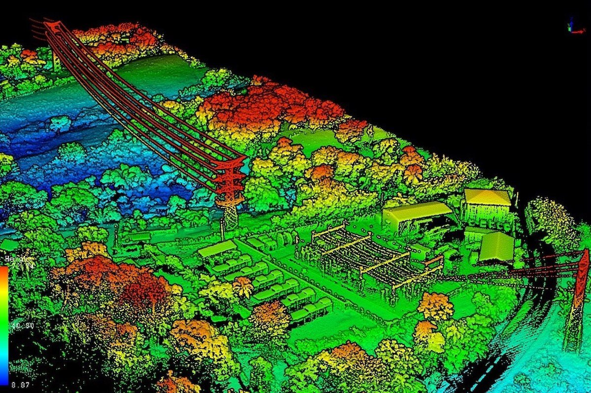
UAV-Based Aerial LiDAR
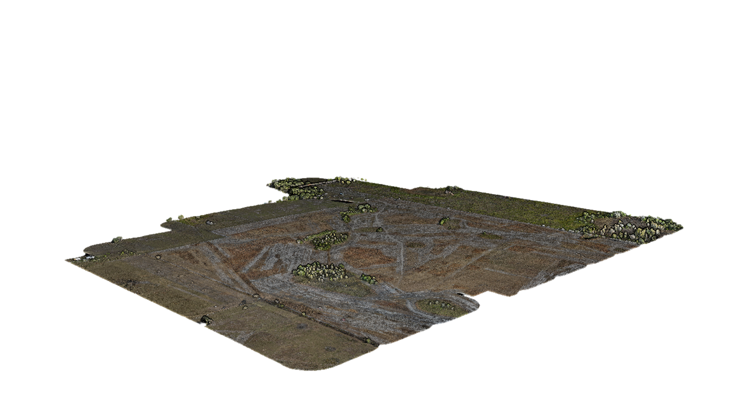
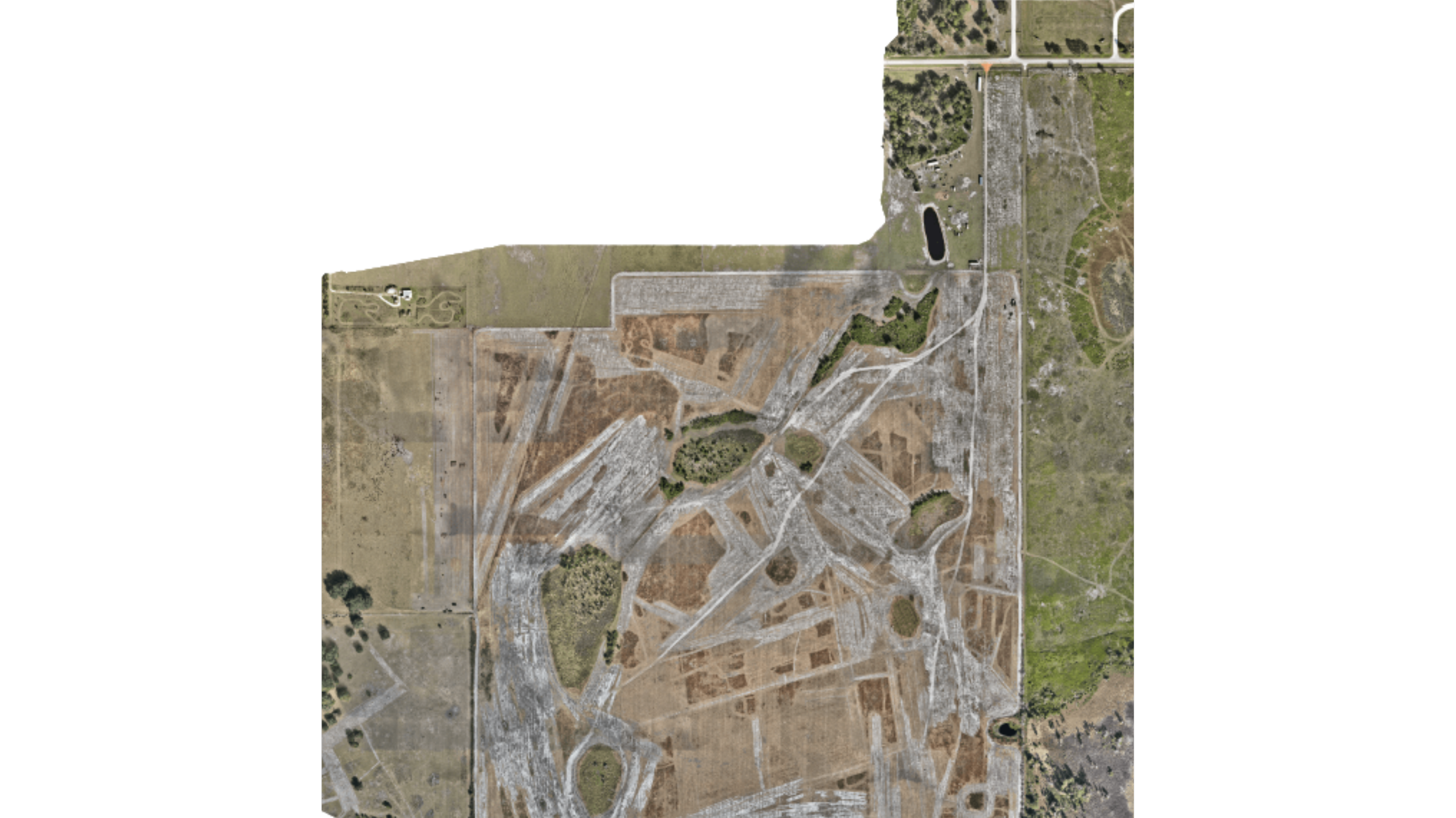
Photogrammetry & Orthomosaics
High‑Accuracy Deliverables
Classified point cloud (LAS/LAZ) – Structured point data ready for surface modeling, feature extraction, and detailed analysis.
Orthomosaic (TIFF) – Georeferenced, true‑to‑scale imagery suitable as a base map for design, planning, and measurement.
DSM, DTM, DEM (TIFF) – Surface and terrain models for grading, drainage, cut/fill, and engineering design.
Contours – Clean contour lines generated from high‑density elevation data for use in CAD and GIS.
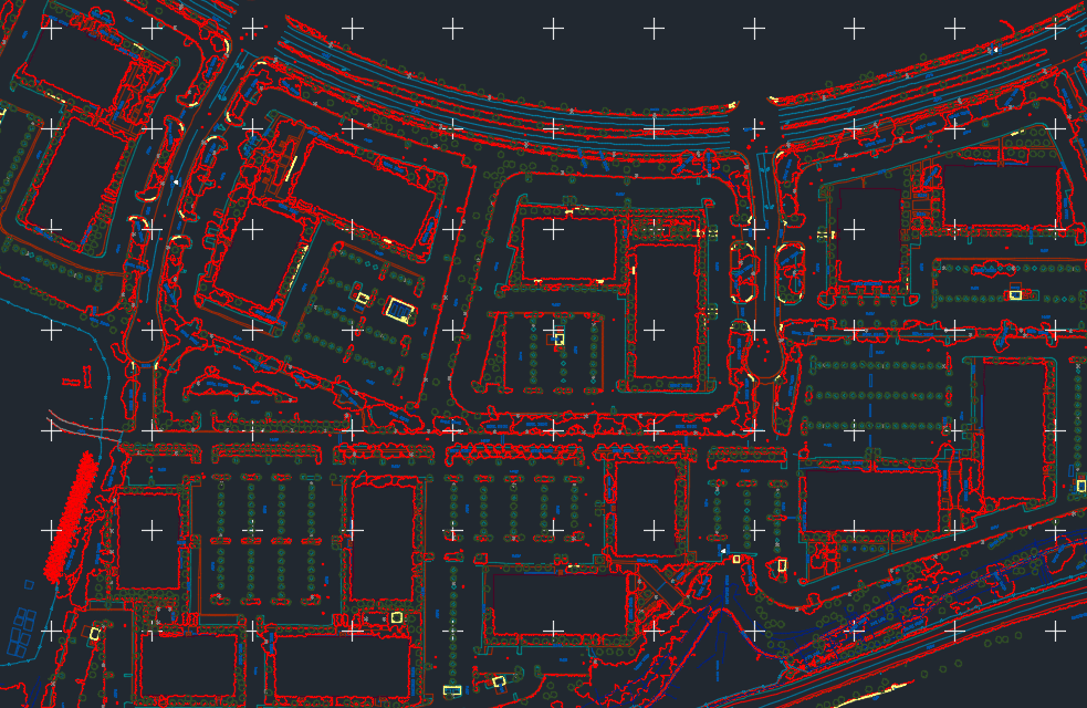
Planimetric / linework (layered DXF) – Organized, layer‑based linework (curbs, edges, pavement, buildings, etc.) for easy import into CAD environments.
Surveyor’s report – Clear documentation of methods, accuracy, coordinate system, and project assumptions to support professional practice and QA/QC.
Additional Offerings
Integration support for CAD, GIS, and BIM systems
Custom ground control strategy design
Vertical accuracy corrections and verification
Professional technical consultation
Team training and workflow integration
Data Processing & QA/QC