High-Resolution Imagery for Design and Planning
Orthorectified aerial imagery and 3D models from high-resolution photography. Provides the visual context your CAD data needs.
When You Need Photogrammetry
Site planning and design visualization
Construction progress documentation
Visual overlay for engineering drawings
Marketing and presentation materials
Pre-construction site assessment
3D context models for stakeholder review
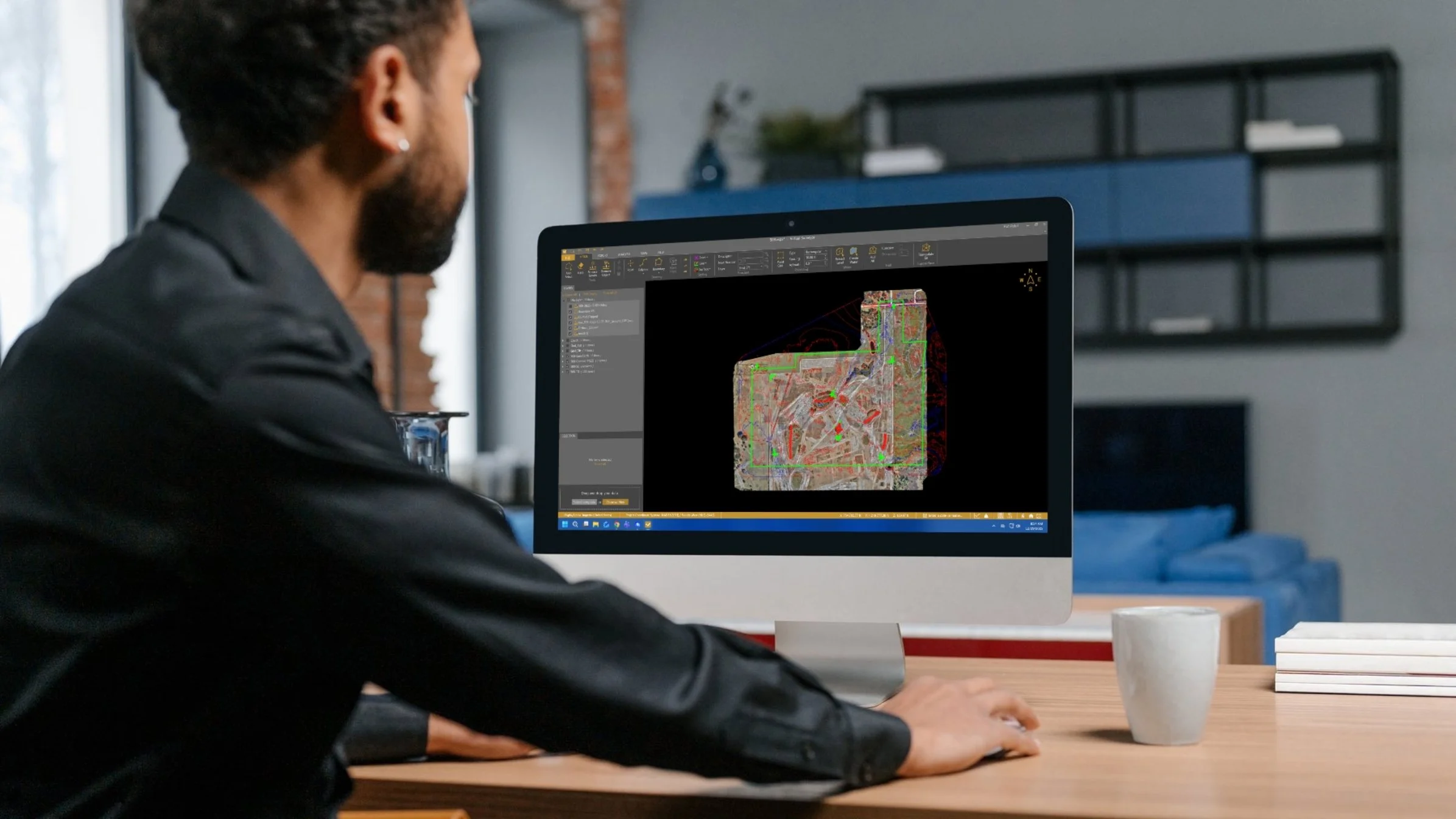
What You Receive
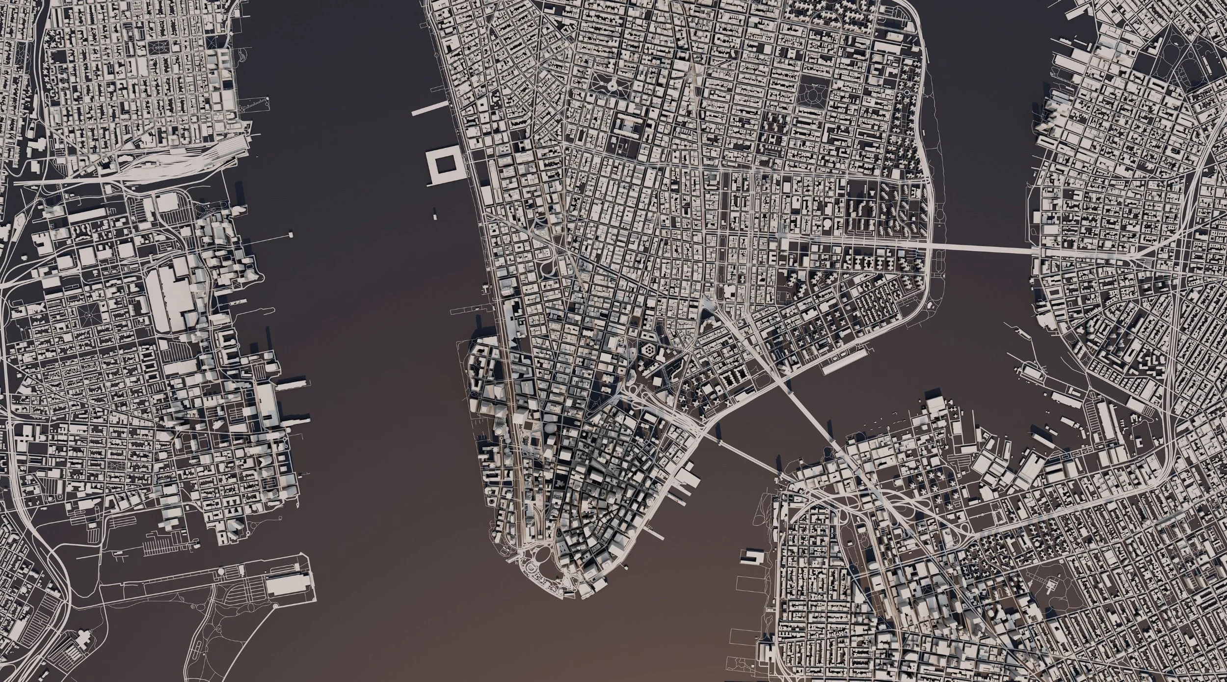
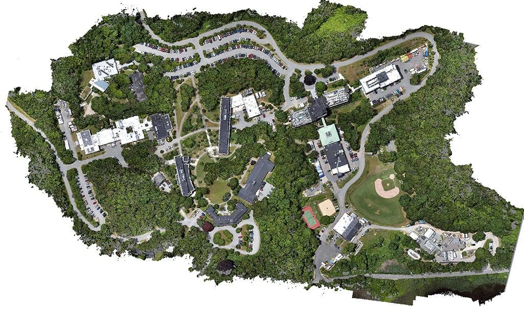
Georeferenced orthomosaic imagery (GeoTIFF/TIFF) – True‑color, seamless, scale‑accurate base maps for design, planning, measurement, and visualization.
Digital Surface Models (DSM) – Elevation models capturing ground plus buildings, vegetation, and other structures derived from image matching.
3D textured mesh models (OBJ and other formats) – Photorealistic 3D representations of sites for design review, clash checks, and stakeholder presentations.
Contour maps at specified intervals – Contours generated from photogrammetric surface/terrain models, delivered for CAD and GIS use.
Planimetric / linework (DWG/DXF, layered) – Digitized features (pavement, striping, buildings, hardscape, etc.) traced from high‑resolution imagery and organized on clean layers for easy CAD import.
High‑resolution presentation imagery – Selected views and exports optimized for reports, proposals, and stakeholder presentations.
Surveyor’s report – Project summary covering image acquisition, control, processing workflow, accuracy checks, coordinate reference, and delivered formats (GeoTIFF, DWG, DXF, or others as specified).
Technical Specifications
Ground Sample Distance: Down to 0.5-2 cm/pixel
RGB or multispectral imaging options
Survey-accurate ground control
Vertical accuracy meets ASPRS standards
Multiple deliverable format options

The Photogrammetry Process
Planning: We determine the optimal flight pattern, ground control strategy, and deliverable specifications for your project.
Data Collection: High-resolution aerial imagery captured with significant overlap for accurate 3D reconstruction. Survey-grade ground control established.
Processing: Advanced photogrammetry software processes imagery into orthorectified mosaics and 3D models. Accuracy verification and quality checks.
Delivery: Production-ready imagery and models in your preferred format. Complete documentation of accuracy and processing methods.
Why Choose 30 South for Photogrammetry?
Great photogrammetry requires both technical expertise and understanding of how imagery will be used downstream. Our licensed surveyors ensure your imagery is accurate, properly georeferenced, and ready for CAD integration or presentation use.
How to Get Started with LiDAR Services
Book a Free Consultation
Reach out to discuss your project, and we’ll help determine the best LiDAR approach to meet your goals.Tailored Survey Plan
We’ll create a customized data collection plan designed to fit your scope, timeline, and budget.Data Delivery & Expert Analysis
Receive comprehensive, actionable data, including 3D models and reports, to help you make informed decisions.